SIGN THE PETITION TO PRESERVE THE REYNOLDS PROPERTY
A 14-lot subdivision is proposed for the nearly 15-acre Cross River property at 831 Route 35.
Add your voice in support of permanent preservation.
SIGN THE PETITION
Responsible Planning. Environmental Stewardship. Community Participation.
Preserve Lewisboro is a resident-led effort promoting responsible land-use planning, protection of the town’s natural resources, and informed public participation in decisions that affect our community.
Our immediate focus is the proposed 14-lot subdivision of the Reynolds property at 831 Route 35 in Cross River. This website provides project updates, public documents, information about the issues under review, and ways for residents to participate in the process.
Latest Update — September 30, 2026
Lewisboro Land Trust Supports Preservation of the Reynolds Property
The Lewisboro Land Trust has voiced its support for preserving the Reynolds property at 831 Route 35 as conserved open space.
In an open letter to the Town Supervisor and Planning Board, LLT’s board opposes the proposed overdevelopment and highlights the property’s conservation value, wildlife habitat, and location next to Ward Pound Ridge Reservation and the Cross River. The letter also recognizes the opportunity to provide local residents with a possible walking connection to the Reservation.
See the full update here.
Proposal at a Glance
Location: 831 Route 35, Cross River
Property: Approximately 15 acres
Proposal: 14 residential lots, a private internal road and associated infrastructure
Access: Proposed from the west end of Mark Mead Road
Current status: Initial sketch-plan review; no approval granted
Next steps: Additional studies, revised plans and a future public hearing
Understanding the Site Plan
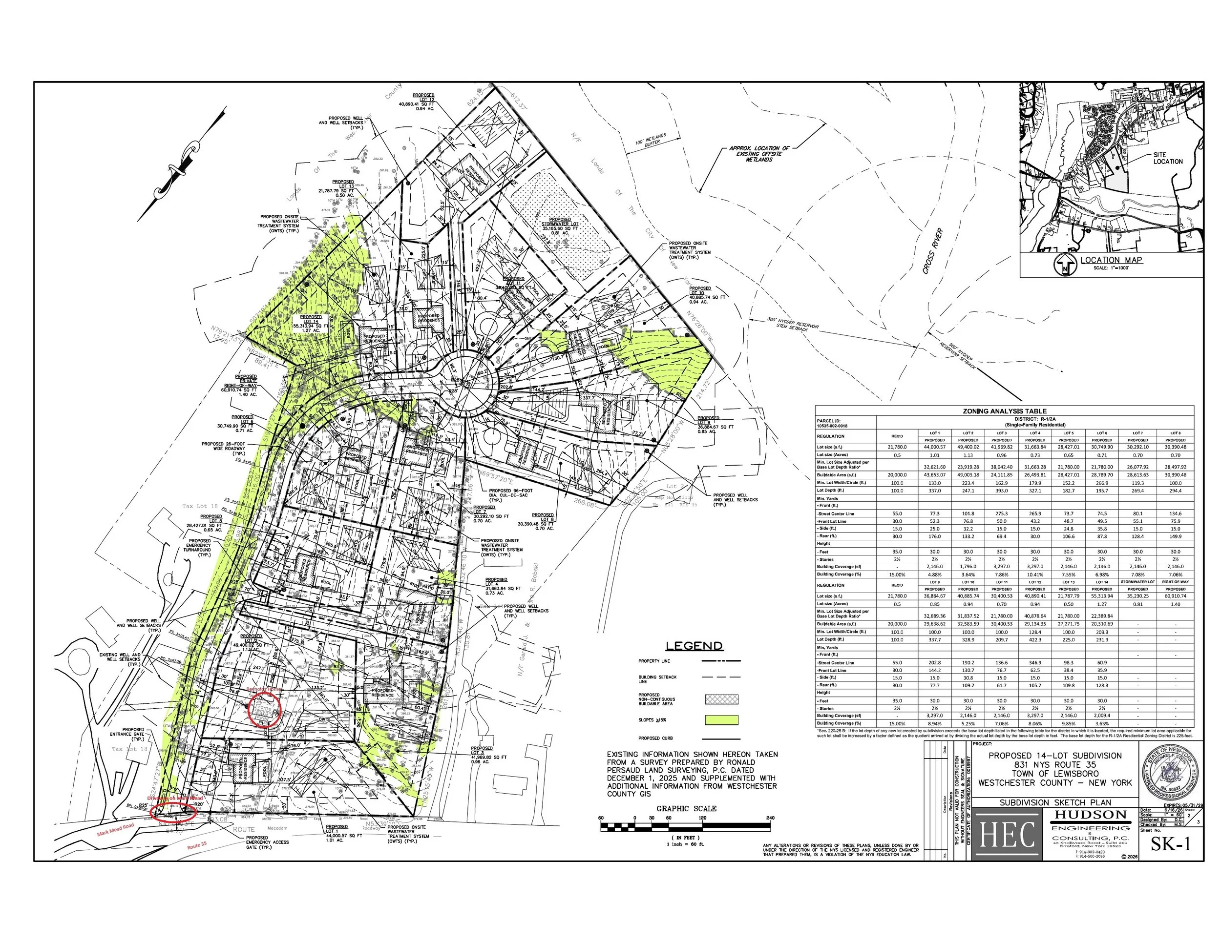
Route 35 runs along the bottom of the plan. The proposed entrance is on Mark Mead Road. The plan depicts 14 homes, an internal road, wells, septic systems, stormwater infrastructure and extensive grading and clearing.
Property Location
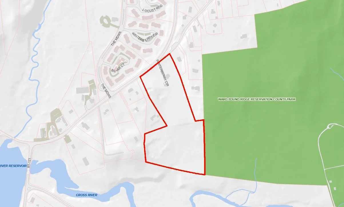
The property lies along Route 35 across from the Meadows, immediately adjacent to Ward Pound Ridge Reservation and the Cross River.
Stay Informed and Participate
Receive Updates
Join the email list for meeting notices, new filings, project developments and opportunities for public participation.
Review the Documents
Read the applicant’s plans, reports, Town consultant comments and other public materials.
Contact the Planning Board
Send relevant concerns or questions to planning@lewisborony.gov
Share Information
Send documents, photographs, historical information or observations to info@preservelewisboro.org
Follow the Events Calendar
Check upcoming Planning Board, Conservation Advisory Council and other relevant Town meetings.